Land Acknowledgment: Payahuunadu has been, and continues to be, the homeland of the Paiute (Nuumu), Shoshone (Newe), and Timbisha peoples. This land acknowledgment honors the original inhabitants of the Eastern Sierra and the tribes who remain here today.
Overview
Kearsarge Pass is one of the most iconic and accessible high mountain passes in the Sierra Nevada. Located just outside of Independence, CA, this hike offers a front-row seat to the dramatic granite landscapes that define Kings Canyon and Sequoia National Parks. A well-maintained trail takes you past a chain of sparkling alpine lakes, dense pine forests, and jaw-dropping vistas before topping out at the 11,760-foot pass.
If you’re looking for a gateway into the High Sierra backcountry—or just want to eat your PB&J with a view—Kearsarge Pass delivers.
Trail Beta
| Trailhead | Onion Valley |
| Route | Kearsarge Pass Trail |
| Mileage | 12.4 miles round trip |
| Elevation Start | 9,200 feet |
| Elevation Gain | 2,600 feet |
| High Point | 11,760 feet |
| Type | Out and Back |
| Difficulty | Moderate |
| Water Sources | Seasonal streams, lakes—filter required |
| Permit Needed | Overnight |
| Dog Friendly | Yes, on leash |
| Land Manager | Inyo National Forest |
Trail Description
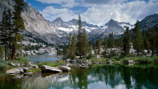
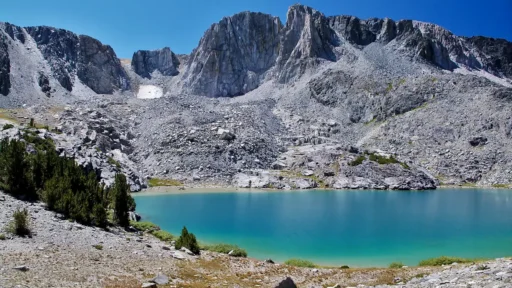
Starting from Onion Valley, the trail climbs steadily through a classic Sierra granite landscape. Early on, you’ll pass Little Pothole Lake, followed by the stunning Gilbert, Flower, and Heart Lakes. Each offers a picture-perfect rest stop—or fishing break, if that’s your vibe.
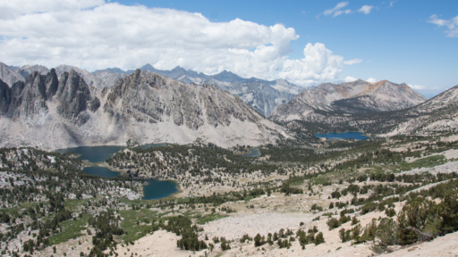
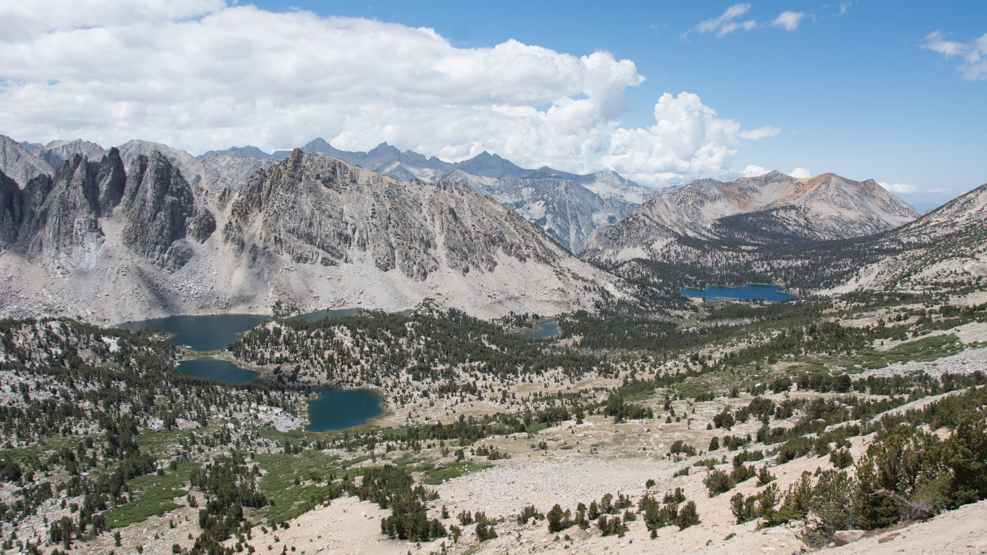
As you gain elevation, the trees thin and the terrain becomes more rugged. The final mile is a series of exposed switchbacks with expansive views of the Owens Valley behind you and craggy peaks ahead. At the top, you’ll be greeted with a panoramic view into Kings Canyon National Park—and maybe a breeze strong enough to steal your hat.
This is an out-and-back trail, so simply retrace your steps after soaking in the view. For backpackers, the pass connects to the John Muir Trail and Rae Lakes Loop.
Best Season to Hike
Late June to early October. Snow often lingers into July. Check the weather with Inyo National Forest before heading out.
Flora & Fauna
Expect Sierra classics like lodgepole pine, aspen, and pockets of wildflowers in early summer. Wildlife sightings include marmots, pikas, deer, and (if you’re lucky) a golden eagle. Bear sightings are rare but possible—store food properly at the trailhead.
Geology
Kearsarge Pass cuts through ancient granite uplifted by Sierra faulting and sculpted by glaciers. The glacial lakes you pass are textbook examples of U-shaped valleys and moraine-dammed basins.
History
The pass and surrounding lakes are named after the USS Kearsarge, a Civil War-era ship. The area was originally traversed by Paiute people long before the modern trail system. Onion Valley was a key route during the mining era, and remnants of that time can still be found in nearby side canyons.
Know Before You Go
• Acclimate: The trailhead starts above 9,000 feet—hydration and pacing are critical.
• Bears: Bear boxes are available at the trailhead. Don’t leave food in your car.
• Weather: Afternoon thunderstorms are common in summer. Start early and be off the pass by midday. If you hear thunder and see lightning on an exposed trail, your immediate priority is to seek shelter and minimize your exposure to the storm . Get to a safe location, crouch low with your head down, and stay away from tall or conductive objects. If possible, try to find a valley or depression in the terrain.
• Dogs: Allowed on leash but keep them under control on steep switchbacks.
Driving Directions
From Independence, turn west onto Onion Valley Road. Follow the winding road 13 miles until it ends at the Onion Valley trailhead parking area. This is a steep, paved mountain road—watch for deer and fallen rocks.
Parking
A large paved parking lot with vault toilets and bear boxes is available at Onion Valley. Arrive early—this trailhead also serves multi-day backpackers and can fill quickly on summer weekends.
Leave No Trace
Please recreate responsibly. Stay on trail, pack out all trash, and respect wildlife. Use designated campsites, bury human waste properly, and filter water. This is a fragile alpine environment—leave it better than you found it.
#packitinpackitout #leaveitbetter #leavenotrace #camplikeapro
AWE Disclaimer: Recreation activities may involve inherent risks, including but not limited to changing weather conditions, challenging terrain, wildlife encounters, and other unforeseen hazards. Visitors should check with local land management agencies or authorities for up-to-date information on trail conditions, access, permits, and regulations before planning their trip. Always prioritize safety by being prepared, carrying adequate supplies, and following Leave No Trace principles to protect the environment. Respect local rules, private property, and other visitors. This post is for informational purposes only, and participation in any activity is at your own risk.