
This article is dedicated to Os Bear. My ride or die, super pup. The backcountry is not the same without you. I miss you so much.
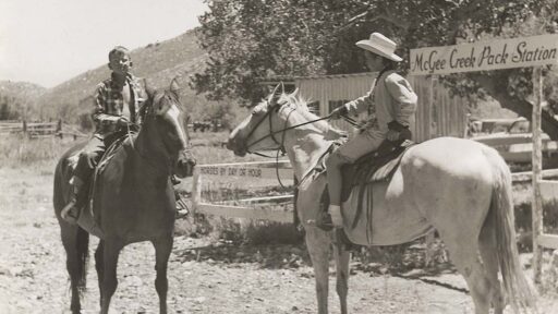
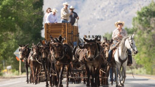
Land Acknowledgment: Payahuunadu has been, and continues to be, the homeland of the Paiute (Nuumu), Shoshone (Newe), and Timbisha peoples. This land acknowledgment honors the original inhabitants of the Eastern Sierra and the tribes who remain here today.
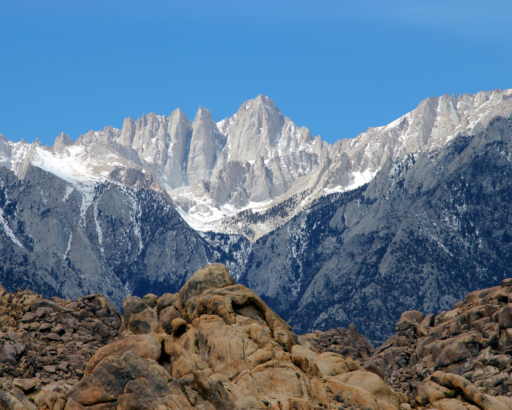
Whitney is the gateway drug. The real Sierra is wilder, quieter, and does not require permits unless you are staying overnight. If you’re only here to tick one peak and bounce, you’re missed the point.
Here are four classic Eastern Sierra hikes that prove the best parts of this range don’t require winning a permit lottery or sharing the trail with 500 other bucket listers.
Note: We do not recommend taking your pup if they are not comfy with at least 12 mile hikes in lower elevations. Also, despite altitude, summer days can still get very hot above 8000 feet. Early starts are key.
1. Lone Pine, CA: Cottonwood Lakes – The Gateway to the High Sierra
📍 Trailhead: Horseshoe Meadow, Lone Pine, CA
🧭 Trail: Cottonwood Lakes
🥾 Distance: ~16.2 miles (to the lakes)
📈 Elevation Gain: ~2,677′ ft’
🏔️ Max Elevation: ~11,200′ ft’
If Mt. Whitney is the heavyweight fight, Cottonwood Lakes is the training montage. It’s got everything you love about the Sierra—big peaks, alpine lakes, solid altitude and endless granite—but no permit stress.
The trail starts at Horseshoe Meadow (10,000 ft), which means you’re already high up before you even break a sweat. The hike itself? Mellow by Sierra standards—a rolling trail through pine forests, meadows, and streams that eventually opens up into a bowl of sapphire-colored lakes backed by the jagged spine of Mt. Langley.
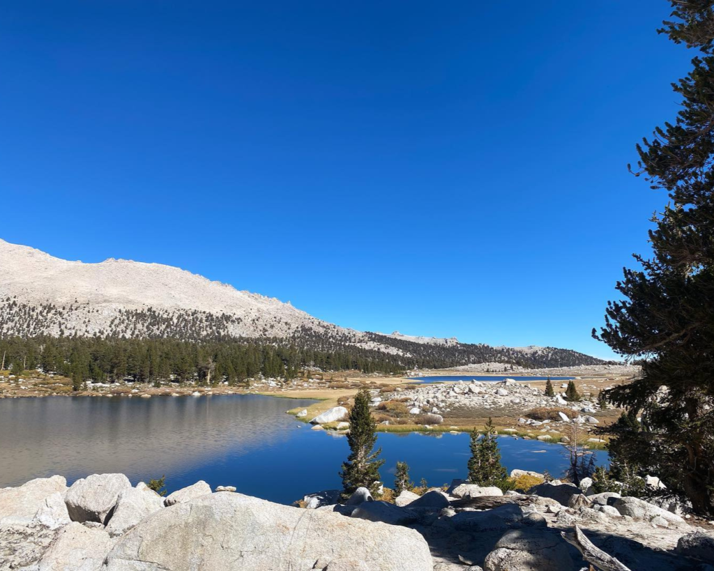
2. Independence, CA: Kearsarge Pass – Epic Backcountry Views
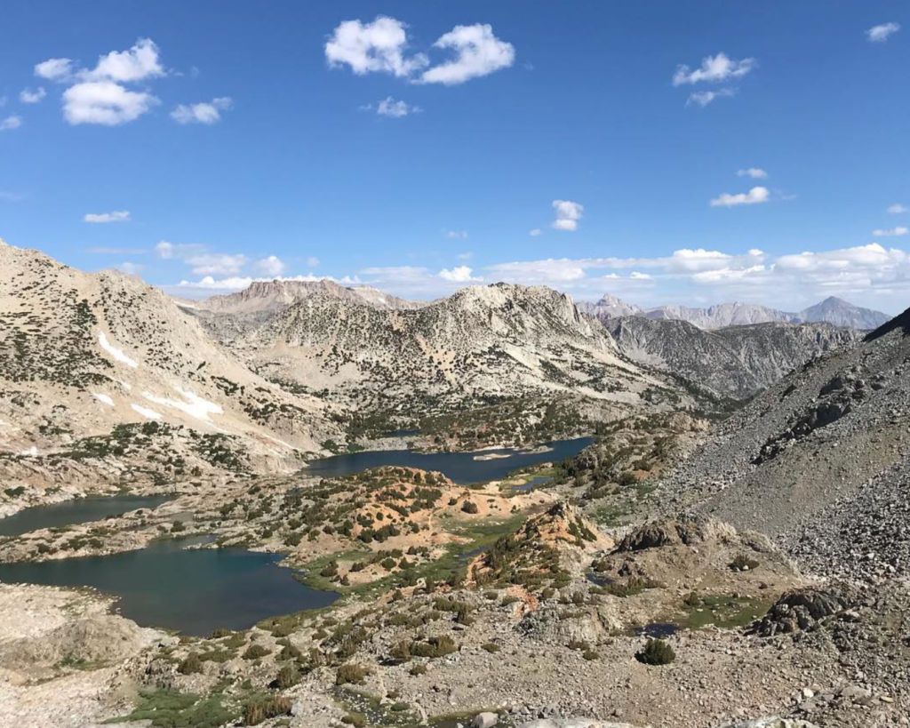
📍 Trailhead: Onion Valley, Independence, CA
🧭 Trail: Kearsarge Pass Trail
🥾 Distance: 12.4 miles
📈 Elevation Gain: ~3,490′
🏔️ Max Elevation: 11,760′ ft’
This stunner of a trail winds past multiple alpine lakes before dumping you onto a pass with epic backcountry views. Standing at 11,760 feet, you’ll look straight into Kings Canyon National Park, a sea of granite, and untouched wilderness. In early summer you will be sharing the trail with PCT’ers, If you meet one on trail, and you feel good about it, give them a ride to tone. It’s common practice in these parts. They super stink but sharing their stoke is totally worth it.
3. Big Pine, CA: Big Pine Lakes – Sierra Eye Candy at Its Absolute Finest
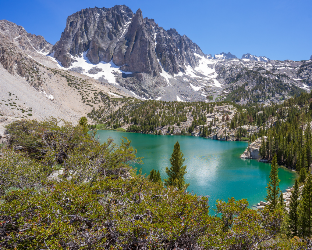
📍 Trailhead: Big Pine Creek, Big Pine, CA
🧭 Trail: North Fork
🥾 Distance: 14.7 miles (to Lake 2)
📈 Elevation Gain: ~3,941′
🏔️ Max Elevation: ~10,800′ ft’
If you’ve ever seen that unreal photo of a neon-blue alpine lake with towering granite peaks you were looking at Big Pine Lakes. This hike takes you deep into the Glacier-Carved Wonderland of the Palisades, where turquoise-colored lakes, towering 14ers, and permanent snowfields create a scene that doesn’t feel real.
4. Bishop, CA: Bishop Pass: A Gateway to Endless Wilderness
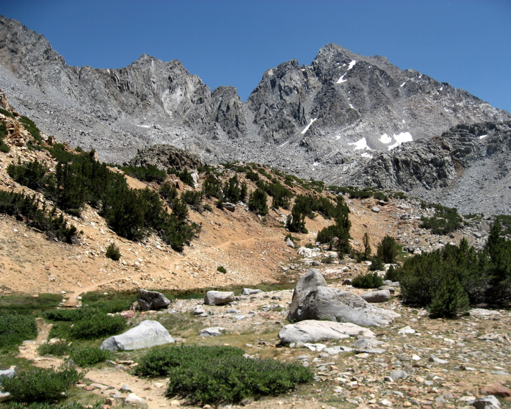
📍 Trailhead: South Lake, Bishop, CA
🧭 Trail: Bishop Pass
🥾 Distance: 11.1 miles
📈 Elevation Gain: ~3,841′
🏔️ Max Elevation: 11,972′ ft’
If you like high places, big views, and trails that feel like they belong in a fantasy novel, Bishop Pass is the move. The hike starts at South Lake (9,700 ft) and climbs gradually past alpine lakes, meadows, and massive granite walls before delivering you to Bishop Pass (11,972 ft)—where you’ll get one of the best panoramic views in the Sierra. On the right day this place is so magical. Basically any day this place is super magical.
Final Thoughts: Whitney is Just the Beginning
If your only Eastern Sierra experience is Mt. Whitney, you’re have only scratched the surface.
These hikes? They’re just as epic, during the week, way less crowded, and require zero lottery stress. Come for Whitney, stay for the real Sierra.
#lovelrural #supportlocal #dontbeakook
A message from AWE
In the ’80s, tossing trash out of car windows was commonplace—until the “Don’t Be a Litterbug” campaign came along and changed behavior on a massive scale. At AWE, we believe the same power of messaging can transform how people care for the places we love to travel and explore. Most people are good, and travel is inevitable—every hike, swimming hole, and climbing spot is just a few clicks away. As content creators, we believe we have a responsibility to weave Leave No Trace principles into everything we share, inspiring travelers to recreate responsibly and minimize their impact on the incredible places so many of us cherish.
Your actions matter: where you walk, how you park, how you treat locals, and even how loud you play your music. It all makes a difference. Search “Leave No Trace” to learn more about responsible recreation and how you can help protect the wild spaces we love and share.
AWE Disclaimer
Recreation activities may involve inherent risks, including but not limited to changing weather conditions, challenging terrain, wildlife encounters, and other unforeseen hazards. Visitors should check with local land management agencies or authorities for up-to-date information on trail conditions, access, permits, and regulations before planning their trip. Always prioritize safety by being prepared, carrying adequate supplies, and following Leave No Trace principles to protect the environment. Respect local rules, private property, and other visitors. This post is for informational purposes only, and participation in any activity is at your own risk.