Land Acknowledgment: Payahuunadu has been, and continues to be, the homeland of the Paiute (Nuumu), Shoshone (Newe), and Timbisha peoples. This land acknowledgment honors the original inhabitants of the Eastern Sierra and the tribes who remain here today.
Overview
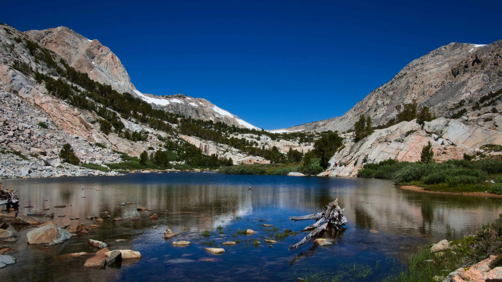
The Piute Pass Trail is one of the most scenic and accessible high-alpine hikes in the Bishop region, beginning at North Lake and climbing through dramatic granite basins, alpine meadows, and crystalline lakes. A gateway into the John Muir Wilderness, this route is popular among day hikers and backpackers heading into Humphreys Basin. It’s a perfect sample of what makes the Sierra so spectacular—without the need to scale a major summit.
Trail Beta
| Trailhead | North Lake Campground |
| Route | Piute Pass Trail |
| Mileage | 9.4 miles round trip |
| Elevation Start | 9,360 feet |
| Elevation Gain | 2,100 feet |
| High Point | 11,423 feet |
| Type | Out and Back |
| Difficulty | Moderate |
| Water | Creeks along the trail (filter) |
| Permit | Overnight |
| Pets | Yes, on leash |
| Land Manager | Inyo National Forest |
Trail Description
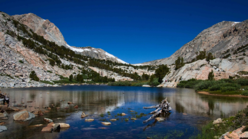
From the trailhead at North Lake Campground, the Piute Pass Trail starts with a moderate climb through pine and aspen forest, following the babbling sounds of the North Fork of Bishop Creek. The trail quickly opens into a granite-lined corridor, revealing Loch Leven and Piute Lake, with ample spots for water breaks, reflection, and photos.
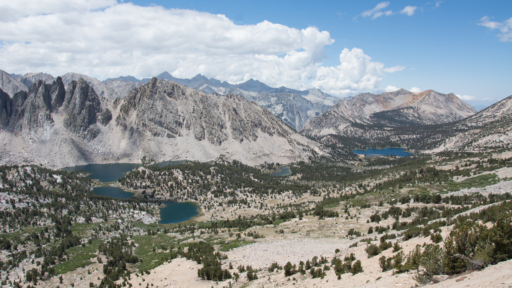
The final push to the pass zigzags through rocky switchbacks, eventually delivering hikers to Piute Pass at 11,423 feet. From here, you’ll overlook the vast expanse of Humphreys Basin and Glacier Divide—an iconic Sierra vista if there ever was one.
Best Season to Hike
June through October, depending on snowpack. Wildflowers peak mid-July, and early fall delivers golden aspens and crisp air. Snow can linger well into early summer—check with the Inyo National Forest for current trail conditions.
Flora & Fauna
You’ll encounter classic Sierra flora—lodgepole pine, whitebark pine, and wildflowers like lupine and Indian paintbrush. Wildlife sightings may include marmots, Clark’s nutcrackers, pika, and mule deer. Black bears are uncommon but possible—always store food properly if backpacking.
Geology
This trail runs through granite country—part of the Sierra Nevada batholith formed over 100 million years ago. Glacial activity carved out the lakes and sculpted the broad U-shaped valleys that define the terrain along this route.
History
The Paiute people have lived in the Bishop area for thousands of years, traveling through these high passes to trade and hunt. The trail lies within the John Muir Wilderness, designated in 1964, and follows a route that early shepherds and explorers likely used in the 19th century.
Know Before You Go
• Altitude: The trailhead starts above 9,000 feet. Take it slow and stay hydrated.
• Weather: Afternoon thunderstorms are common in summer. Start early and be off the pass by midday. If you hear thunder and see lightning on an exposed trail, your immediate priority is to seek shelter and minimize your exposure to the storm. Get to a safe location, crouch low with your head down, and stay away from tall or conductive objects. If possible, try to find a valley or depression in the terrain.
• Bugs: Mosquitoes can be intense in early summer—bring repellant.
• Leave No Trace: Stay on trail, pack out trash, and avoid cutting switchbacks.
Driving Directions
From Bishop, take CA-168 W (West Line Street) for 18 miles. Turn right onto North Lake Road and follow it for 2 miles to the North Lake Campground. The road is narrow with switchbacks—RVs not recommended.
Parking
Parking is available near the North Lake Campground, though it fills early in peak season. Arrive before 8 AM for best availability. Overflow parking may require a short walk to the trailhead.
Leave No Trace
Please recreate responsibly. Pack out all trash, stay on marked trails, avoid trampling vegetation, and follow local guidelines for waste and wildlife. Respect the land and those who live on it—past and present.
#packitinpackitout #leaveitbetter #leavenotrace #camplikeapro
AWE Disclaimer:Recreation activities may involve inherent risks, including but not limited to changing weather conditions, challenging terrain, wildlife encounters, and other unforeseen hazards. Visitors should check with local land management agencies or authorities for up-to-date information on trail conditions, access, permits, and regulations before planning their trip. Always prioritize safety by being prepared, carrying adequate supplies, and following Leave No Trace principles to protect the environment. Respect local rules, private property, and other visitors. This post is for informational purposes only, and participation in any activity is at your own risk.