Overview
Lone Pine Lake is a perfect introduction to the Mount Whitney Trail and offers stunning views without requiring a full summit effort. Nestled in the Eastern Sierra just outside Lone Pine, California, this out-and-back trail leads to a serene alpine lake with granite cliffs, sweeping vistas, and just enough climb to earn your lunch spot. Although it shares the same trail as the Mount Whitney summit route, Lone Pine Lake doesn’t require the full Whitney permit, making it ideal for hikers who want high-alpine beauty without the extreme elevation gain.
Quick Stats
| Mileage | 5.8 miles round trip |
| Route | Mt. Whitney Trail |
| Elevation Start | 8,360 feet |
| Elevation Gain | 1,640 feet |
| High Point | 9,900 feet |
| Type | Out and Back |
| Difficulty | Moderate |
| Water Sources | Seasonal streams, bring your own water |
| Permit Needed | Overnight |
| Dog Friendly | Yes |
| Land Manager | Inyo National Forest |
Trail Description
The trail to Lone Pine Lake begins at the Whitney Portal trailhead, immediately climbing through a shaded forest of pine, fir, and aspen. Switchbacks dominate the early stretch, with the soothing sound of Lone Pine Creek keeping you company as you climb.
The grade is steady but manageable, with well-maintained trail conditions. About halfway up, you’ll pass the turnoff for the North Fork of Lone Pine Creek (used to access Mount Russell and Mountaineer’s Route). Continue on the main trail until you reach a signed junction just below the 10,000-foot mark—this is your spur to Lone Pine Lake.
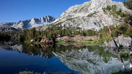
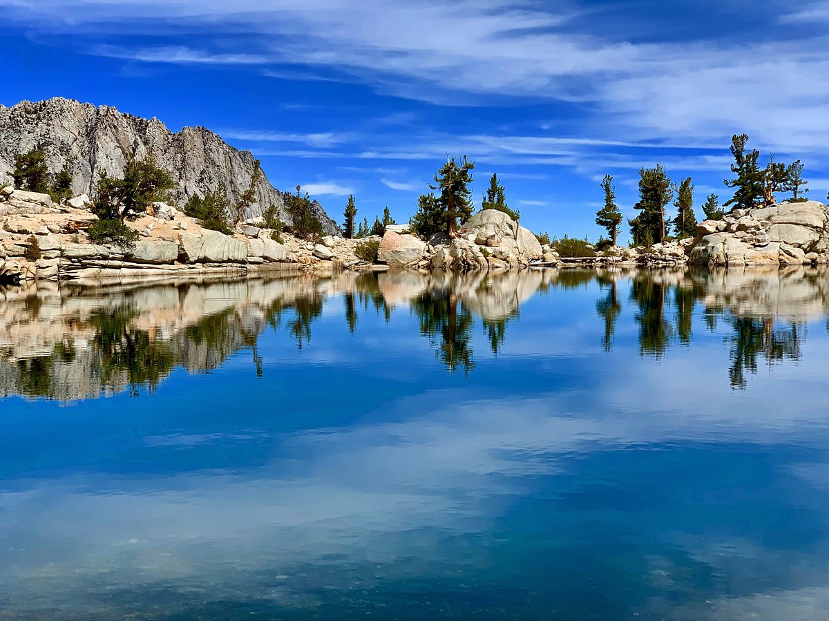
From here, it’s a short descent to the lake basin, where the trees open up to reveal a glassy alpine lake framed by sheer granite cliffs. It’s a fantastic lunch stop, photography spot, or even a place to dip your feet if you’re brave.
Best Season to Hike
Late May through October, depending on snow conditions. The trail can hold snow into early summer, so check with the Inyo National Forest ranger station for current conditions. Fall brings golden foliage and fewer crowds.
History
This trail travels through Paiute-Shoshone ancestral lands. The region was—and remains—culturally and spiritually significant to Indigenous peoples. The Whitney Portal trail as we know it was built to support early climbing expeditions to Mt. Whitney in the late 1800s and has since become one of the most famous routes in the Sierra Nevada.
Geology
The granite cliffs and glacial valleys of the Whitney Zone were carved by ancient glaciers and tectonic uplift. Lone Pine Lake itself is a classic example of a cirque lake—formed in a bowl-shaped depression left by retreating glaciers.
Flora & Fauna
You’ll hike through classic Sierra conifer forest with pine, fir, and the occasional aspen grove. In spring and early summer, wildflowers dot the trail, especially lupine, Indian paintbrush, and Sierra columbine. Keep an eye out for Steller’s jays, marmots, and the occasional mule deer. Bears are active in this area—bear-proof food storage is required at Whitney Portal.
Know Before You Go
• Weather: Afternoon storms are common in summer. Start early and aim to be descending by early afternoon. If you hear thunder and lighting, bail.
• Bears: Bear-proof storage is required at Whitney Portal and advised for day hikes. Do not leave food in your car.
• Acclimatize: The trail starts above 8,000 feet— hydrate well.
Driving Directions
From the town of Lone Pine, take Whitney Portal Road west for approximately 13 miles until the road dead-ends at Whitney Portal. The drive gains serious elevation, so take it slow and enjoy the views.
Parking
Large parking lots are available at Whitney Portal. Arrive early, especially on weekends or during summer months. Overflow lots are available but require a short walk to the trailhead.
Leave No Trace
Please recreate responsibly. Pack out all trash, stay on marked trails, avoid trampling vegetation, and follow local guidelines for waste and wildlife. Respect the land and those who live on it—past and present.
#packitinpackitout #leaveitbetter #leavenotrace #camplikeapro
AWE Disclaimer: Recreation activities may involve inherent risks, including but not limited to changing weather conditions, challenging terrain, wildlife encounters, and other unforeseen hazards. Visitors should check with local land management agencies or authorities for up-to-date information on trail conditions, access, permits, and regulations before planning their trip. Always prioritize safety by being prepared, carrying adequate supplies, and following Leave No Trace principles to protect the environment. Respect local rules, private property, and other visitors. This post is for informational purposes only, and participation in any activity is at your own risk.