Land Acknowledgment: Payahuunadu has been, and continues to be, the homeland of the Paiute (Nuumu), Shoshone (Newe), and Timbisha peoples. This land acknowledgment honors the original inhabitants of the Eastern Sierra and the tribes who remain here today.
Overview
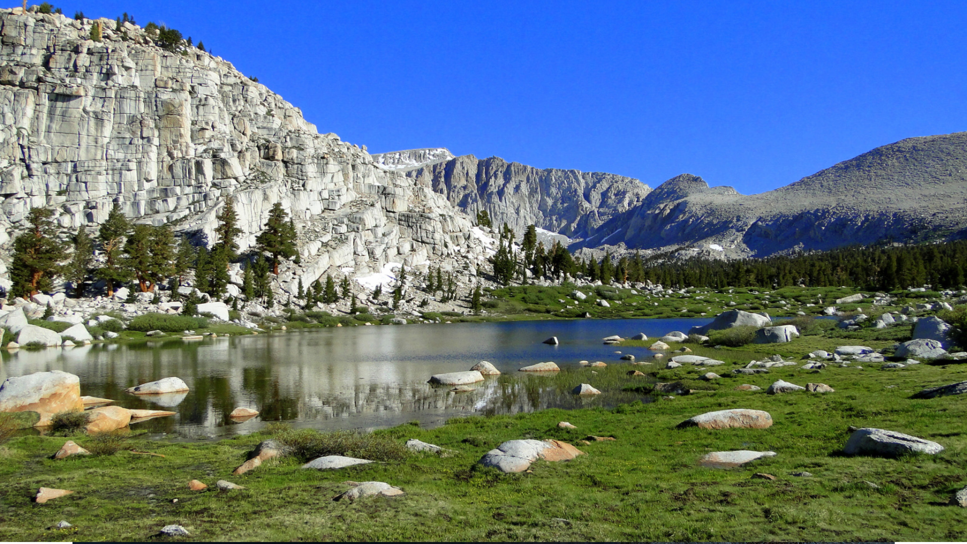
The Cottonwood Lakes Trail is one of the most rewarding high-altitude hikes in the Eastern Sierra, located just outside Lone Pine at Horseshoe Meadows. This trail offers a stunning alpine journey into the southern Sierra Nevada, with access to up to five beautiful lakes nestled below Mount Langley. The relatively mellow elevation gain, wide trail, and starting altitude of 10,000 feet make it ideal for hikers looking to acclimate or escape summer heat.
While many tackle this route as a day hike to the lower lakes, it also serves as a gateway for overnight trips deeper into the wilderness or up to 14,026’ Mount Langley.
Beta
| Trailhead | Horseshoe Meadows |
| Route | Cottonwood Lakes Trail |
| Mileage | 11.2 miles round trip |
| Elevation Start | 10,040 feet |
| Elevation Gain | 1,400 feet |
| High Point | 11,400 feet |
| Type | Out and Back |
| Difficulty | Moderate |
| Water Sources | Seasonal streams, bring your own |
| Permit Needed | Overnight |
| Dog Friendly | Yes (on leash) |
| Land Manager | Inyo National Forest |
Trail Description
From the trailhead at Horseshoe Meadows, you’ll start your hike beneath a canopy of lodgepole pines, immediately greeted with views of cirques and granite ridgelines. The path is wide and well-maintained, with several stream crossings in early season.
Roughly 2.5 miles in, you’ll encounter your first junction—stay left to head toward Cottonwood Lakes (the right takes you to Cottonwood Pass). The trail continues through open meadows, crossing Cottonwood Creek and gradually climbing through forest and alpine tundra. You’ll reach the first lakes around 5 miles in. Expect crystal-clear water, golden trout sightings, and the kind of high Sierra silence that makes the soul exhale.
If you’re feeling ambitious, extend your trip to Muir Lake or New Army Pass—but many are happy to lunch, lounge, and turn around at Lakes 4 or 5.
Best Season to Hike
Late June through October. Snow may linger into early summer, especially near the lakes and passes. Late summer and fall provide the best conditions—fewer mosquitoes, stable weather, and golden-hued meadows.
Flora & Fauna
Look for lodgepole pines, alpine meadows filled with wildflowers, and hardy sagebrush. Wildlife includes golden-mantled ground squirrels, marmots, mule deer, and the occasional pika. This is a designated golden trout heritage area—keep your eyes peeled in the lakes and creeks.
Geology
The Cottonwood Lakes basin is classic glacial terrain—U-shaped valleys, moraines, and massive granite walls carved over time. The entire region is underlain by Sierra Nevada granite, sculpted by ice and water into today’s dramatic alpine playground.
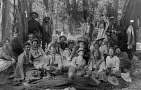
History
This area was traditionally used by the Paiute people, who moved seasonally through these high meadows. Horseshoe Meadows Road was constructed in the mid-20th century, offering modern access to what was once extremely remote terrain. Today, the trail is part of the Inyo National Forest and protected as part of the John Muir Wilderness.
Know Before You Go
• Altitude: You’re starting at 10,000 feet—acclimate accordingly and hydrate well.
• Weather: Afternoon thunderstorms are common in summer. Start early and descend by 2 PM. If you hear thunder and lighting turn around.
• Mosquitoes: Bad in early season—bring protection.
• Bears: Store food properly, especially if overnighting.
• Toilets: Vault toilets at trailhead. Pack out all trash and waste.
Driving Directions
From Lone Pine, turn west on Whitney Portal Road, then left on Horseshoe Meadows Road. Follow this steep and winding road for about 19 miles until it ends at Horseshoe Meadows Campground and trailhead.
Parking
Plenty of parking at Horseshoe Meadows Trailhead. Arrive early on weekends or holiday weekends—this is a popular trail for both backpackers and day hikers.
Leave No Trace
Please recreate responsibly. Stay on trail, pack out all trash and toilet paper, avoid trampling vegetation, and respect wildlife and other hikers.
#packitinpackitout #leaveitbetter #leavenotrace #camplikeapro