

Land Acknowledgment: Payahuunadu has been, and continues to be, the homeland of the Paiute (Nuumu), Shoshone (Newe), and Timbisha peoples. This land acknowledgment honors the original inhabitants of the Eastern Sierra and the tribes who remain here today.
Overview
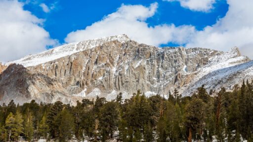
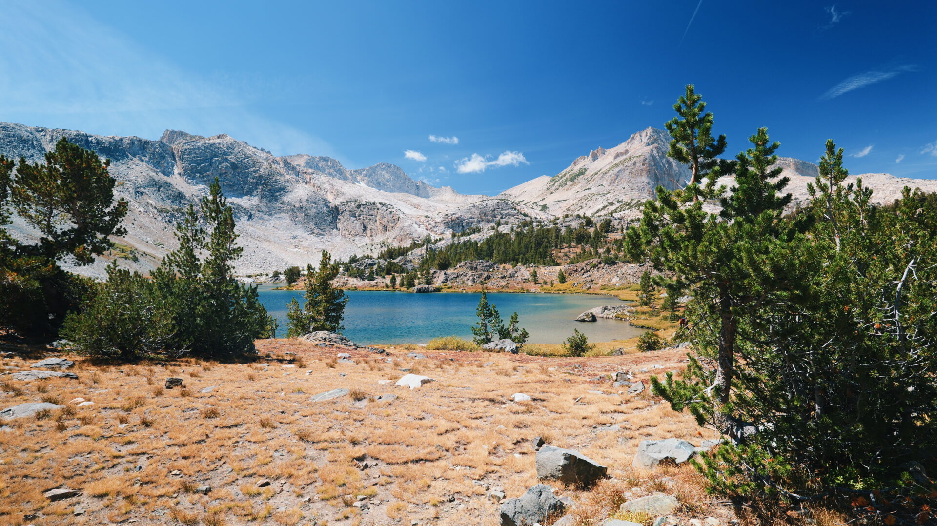
Just outside Yosemite National Park, Twenty Lakes Basin delivers one of the biggest scenic payoffs for the effort in the Eastern Sierra. Beginning at Saddlebag Lake, the route travels through the Hoover Wilderness and passes a chain of alpine lakes surrounded by colorful peaks, polished granite, and wide-open high-country views.
Despite starting above 10,000 feet, the trail has relatively little sustained climbing. Aside from two short uphill sections, the route rolls gently through the basin. It is an approachable high-alpine adventure with almost nonstop scenery—basically an “ooh, ahh” hike from beginning to end.
Trail Beta
| Trailhead | Saddlebag Lake Trailhead |
| Route | Twenty Lakes Basin Loop |
| Mileage | ~8 miles |
| Elevation Start | 10,080 feet |
| Elevation Gain | ~900 feet |
| High Point | ~10,500 feet |
| Type | Loop |
| Difficulty | Easy to Moderate |
| Water Sources | Lakes and seasonal creeks (treat before drinking) |
| Permit Needed | Overnight trips only |
| Dog Friendly | Yes, on leash |
| Land Manager | Inyo National Forest / Hoover Wilderness |
Trail Description
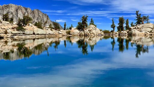
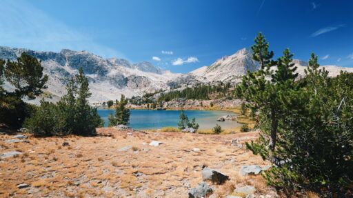
The hike begins near the Saddlebag Lake dam with expansive views across the water. Hikers can follow either side of the lake to reach the basin, though the eastern shore provides a more direct start. Beyond Saddlebag Lake, the route enters a broad alpine landscape filled with clear lakes, rocky shorelines, meadows, and dramatic mountain backdrops.
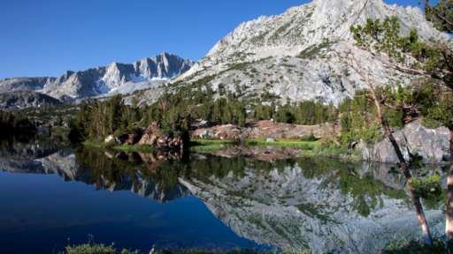
The loop passes several named lakes, including Hummingbird, Odell, Helen, Shamrock, Steelhead, Cascade, and Greenstone. The terrain is mostly gentle, with only two short sections of more noticeable climbing. Because the trail stays above 10,000 feet, however, even modest inclines can feel more demanding for hikers who are not acclimated.
One of the highlights is reaching the northern side of the basin and looking down into upper Lundy Canyon. It is especially fun to return to this familiar Eastern Sierra landscape from an entirely different direction.
We hiked the loop on September 2, 2026, as the first hints of fall were beginning to appear. The colors across the basin were shifting, the air felt crisp, and we spent the day bouncing between sun shirts and puffies. Midweek traffic was light, allowing plenty of time to enjoy the lakes and views without feeling crowded.
Best Season to Hike
July through September is generally the most reliable window for hiking Twenty Lakes Basin. Snow can linger well into early summer, while early fall brings cool temperatures, subtle color changes, fewer hikers, and the possibility of an early-season storm.
The basin sits above 10,000 feet, so conditions can change quickly at any time of year. Bring layers—even when the forecast looks sunny—and check road and trail conditions before leaving home.
Flora & Fauna
The high-elevation landscape supports hardy alpine vegetation, low-growing wildflowers, willows, and scattered whitebark and lodgepole pines. Wildflowers are most prominent in summer, while early September brings the first subtle shifts toward fall.
Marmots, pikas, mule deer, and a variety of alpine birds may be seen around the basin. This is also sensitive habitat for the Yosemite toad. Observe wildlife from a distance and avoid disturbing wet meadows, shorelines, and other fragile habitat.
Geology
Twenty Lakes Basin is a classic glacially shaped Sierra Nevada landscape. Ancient ice carved the broad basin and left behind polished granite, rocky moraines, cirques, and depressions that now hold its many alpine lakes.
The surrounding terrain includes both familiar Sierra granite and striking reddish metamorphic peaks, giving the basin a more varied appearance than many nearby high-country destinations.
History
Twenty Lakes Basin lies within the ancestral homelands of Indigenous peoples who traveled through and cared for the Eastern Sierra long before modern roads and recreation trails were established.
Saddlebag Lake was enlarged by the construction of a dam in 1919. Today, it serves as a popular gateway to hiking, fishing, camping, and backpacking in the Hoover Wilderness.
Know Before You Go
• Altitude: The hike begins above 10,000 feet. Hydrate, pace yourself, and know the symptoms of altitude sickness.
• Weather: Conditions change quickly in the high country. Carry sun protection, warm layers, rain protection, and a puffy or insulated jacket.
• Navigation: Several trails and informal paths intersect within the basin. Carry a map or downloaded route and confirm junctions as you travel.
• Trail Conditions: Snow, runoff, and seasonal storms can affect the route. Check current conditions with Inyo National Forest before your trip.
• Camping: A wilderness permit is required for overnight travel. Campfires are prohibited in the Twenty Lakes Basin, and camping is prohibited in designated restoration areas around several lakes.
• Water Taxi: When operating, the Saddlebag Lake water taxi can shorten the hike by carrying visitors across the lake. Hours and availability vary, so confirm service in advance.
Driving Directions
From Lee Vining, travel west on Highway 120 toward Tioga Pass for approximately 12 miles. Turn onto Saddlebag Lake Road and follow it for about three miles to the lake and trailhead.
Saddlebag Lake Road is seasonal and may be rough in places. Check current access conditions before traveling.
Parking
Trailhead parking is available near the Saddlebag Lake dam. The area can fill quickly on summer weekends, so arrive early or visit midweek when possible.
We visited on a weekday in early September and encountered relatively few people on the trail.
Leave No Trace
Please recreate responsibly. Pack out all trash, stay on marked trails, avoid trampling vegetation, and follow local guidelines for waste and wildlife. Respect the land and those who live on it—past and present.
This is a sensitive high-alpine environment with a short growing season. Every careful footstep helps protect it.
AWE Disclaimer: Recreation activities may involve inherent risks, including but not limited to changing weather conditions, challenging terrain, wildlife encounters, altitude, and other unforeseen hazards. Visitors should check with local land-management agencies or authorities for current information on trail conditions, road access, permits, regulations, and closures before planning a trip.Always prioritize safety by being prepared, carrying adequate supplies, and following Leave No Trace principles. Respect local rules, private property, cultural resources, wildlife, and other visitors. This post is for informational purposes only, and participation in any activity is at your own risk.