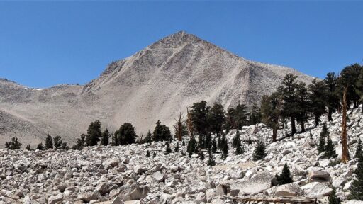
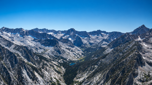
One of the highest trail-accessible summits in California, Mt. Dana offers a rare opportunity to stand above 13,000 feet without technical climbing or a wilderness permit. Located just outside Yosemite National Park near Tioga Pass, the route climbs steadily through alpine tundra, historic mining remnants, and expansive high-country terrain before reaching a 13,061-foot summit with sweeping views of Yosemite, Mono Lake, the Dana Plateau, and the rugged peaks of the Eastern Sierra.
The trail is short by Sierra standards, but don’t let the mileage fool you. Starting above 9,900 feet and climbing more than 3,000 feet in just a few miles, Mt. Dana is a relentless ascent that demands strong fitness and respect for altitude. For hikers looking to experience one of California’s most spectacular summit views without technical climbing, few peaks deliver a bigger reward.
Trail Beta
| Town | Lee Vining |
| Trailhead | Tioga Pass |
| Route | Mt. Dana Trail |
| Mileage | 6 |
| Elevation Start | 9,945′ |
| Elevation Gain | 3,120′ |
| High Point | 13,061′ |
| Type | In & Out |
| Difficulty | Challenging |
| Class | 1 |
| Water | None |
| Permit | Overnight |
| Pets | No |
| Land Manager | Yosemite National Park |
Disclaimer: The information provided by AWE is for informational and educational purposes only and should not be considered professional outdoor, medical, safety, or navigation advice. Trail conditions, weather, road access, water availability, permit requirements, and other factors can change at any time. Always do your own research, check current conditions, carry appropriate gear, know your limits, and make decisions based on your experience and the conditions you encounter. Recreate responsibly, follow Leave No Trace principles, respect wildlife and cultural resources, and leave every place better than you found it.